Hverfjall, The Volcano to Walk,
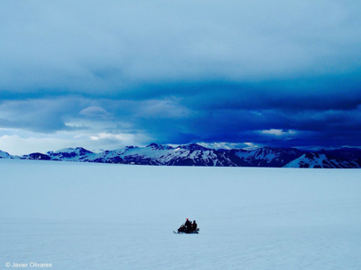
Once you reach the top of Hverfjall volcano you can walk around the crater at your own pace but in general it takes 1 hour. From the rim of the crater you're rewarded with magnificent views of the crater itself, as well as the landscape including Lake Myvatn and surrounding mountains.
Baula, West Iceland,
Baula is a volcanic mountain of a very special pyramidic form. It measures 934 m in height. The mountain is a 3 million years old intrusion, consisting of liparit stone.
way. For people in good shape, it is well possible to hike up on the mountain from Bjarnardalur, road number 60. But its sides are very steep and there are big and loose stones on the On t e other hand, the view of the top is very rewarding and you can write into a guestbook there.
Reynisfjara beach, Reynisfjall mountain and Reynisdrangar sea stacks.
Reynisfjall is a 340 m high tuff mountain arising out of a volcanic eruption from under a glacier in the penultimate Ice Age, near the village of Vík, Suðurlandi.
Alternating in an irregular manner are layers of tuff, pillow lava and columnar basalt veins and loops. Reynisdrangar stacks are a collection of 66 m high rock pillars that rise out of the sea and are of the same geological formation as Reynisfjall. On Reynisfjöru beach, very beautiful basalt formations in the south part of the mountain can be seen, and there you will find an exceedingly beautiful cave called Hálsanefshellir.
Dyrhólaey Arch from Reynisfjara, Vík í Mýrdal, Suðurlandi.
The stone arch rises up to 120 meters high, allowing a view of the surrounding beaches and the rough ocean that punishes this area of Iceland.
Dyrhólaey is really an island that has been joined to the rest of Iceland by the beaches and marsh areas that surround it. From high above, the cliffs present us with the wild Atlantic Ocean, but if we turn around and look up into the highlands, we will see the Mýrdalsjökull glacier cap, reminding us that the North Pole and Greenland are not that far away.
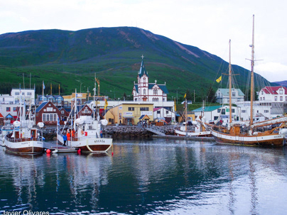
Húsavík Church, Norðurland Eystra
Húsavík is a town on the eastern shores of The Skjalfandi Bay.
The state architect, Rognvaldur Olafsson, designed the church. It was built in the form of a cross with wood imported from Norway, and consecrated on June 2nd 1907.
The tower is 26 metres high. The church’s design is different from other churches in Iceland, because it does not have the familiar pulpit.
The artist Freymodur Johannesson painted and decorated the church’s interior in 1924.
Iceland flag, in the Þingvellir National Park
The Þingvellir Valley is one of the stops on the Golden Circle Route. This National Park located about 45 km from the capital, Reykjavik is one of the most important historical places in Iceland. It combines in an exceptional natural environment of 237 km2, a good part of Icelandic history.
Bláa lónið, Grindavík
The Blue Lagoon (Icelandic: Bláa lónið) is a geothermal spa located in the southwest of Iceland. It is one of the most visited attractions in the country, where the vaporous waters are part of a lava formation. Temperate waters are rich in minerals like silica and sulfur in the Blue Lagoon. The temperature of the water in the bath and the swimming area of the lagoon averages 41° C (104° F).
If you have come this far, I thank you very much for stopping to see.
